The mission of the Arkansas River Water Trail is to inspire people and communities to conserve and protect the history and natural diversity of the Arkansas River, and to foster opportunities for recreation and education.
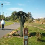
The Arkansas River Water Trail route currently consists of 22 established river access points, providing trip lengths from just over 1 mile that could be easily paddled in an evening, to more th
an 20 miles paddled with an overnight camp between two days. A listing of suggested trips provides a brief description of the landscape, natural history, travel time and difficulty of each trip, with a starting and ending point. Several gaps in access do exist, but additional sites are planned with several near the construction phase. A complete list of existing access points, with descriptions and photos of each is attached.
(ARWT_Sec2_1_AccessPointFiles.pdf)
(ARWT_Sec2.1_FloatDistances.pdf)
(ARWT_Sec2.1_RecommendedFloats.pdf)
Several opportunities and outreach programs are in place surrounding the Arkansas River Water Trail. Facilities such as the WATER Center and Exploration Place, NGOs such as the Arkansas River Coalition, and groups such as Wichita Clean Streams provide public outreach programming on water resources, cultural heritage, boating skills and outdoor ethics. The annual Wichita Riverfest has been held on the banks of the Arkansas River in downtown Wichita every year since 1972, and is the largest community-wide event in the city.
The Wichita Riverfest | www.wichitariverfest.com
An estimated 50% of Sedgwick County residents attend at least one day of this 10-day festival each year to enjoy food, music and events inspired by the Arkansas River. With an annual economic impact of up to $14 million, this event is easily the largest and most well-attended event in the city. The festival has had several name changes over time, but has been held every year for the last 43 years! Music, fireworks, a carnival, food vendors, zip lining over the river and paddling are just some of the events enjoyed by festival goers. Riverfest continues to be what the original founders had intended, a mechanism to build community pride, bring people together and focus attention on our great natural resource - the Arkansas River. Photos, events and finer details of Riverfest are available at www.wichitariverfest.com.
The Arkansas River Coalition | www.arkrivercoalition.org
The Arkansas River Coalition (ARC) is a 501(c)(3) organization whose members can be individuals, families, organizations, towns or cities: anyone with an interest in the Arkansas River and a willingness to accept and participate in our mission. Although headquartered in Wichita, Kansas, we welcome members from any part of the river basin / watershed and those outside the basin who have an interest in its protection and enjoyment. The ARC is led by a Board of Directors consisting of nine members.
The mission of the ARC is to protect, restore and improve the entire Arkansas River watershed and enhance the well-being of all life it sustains.
The ARC believes that one of the best ways of getting people to care for a river is for them to experience it and take ownership in it. The best way of experiencing a river is to get out on it, in a boat. The ARC organizes floats on the river and its tributaries during the spring, summer and fall months, as well as a polar float in January. The majority of these floats take place along sections of the river in Kansas from Great Bend to the KS/OK border.
In addition to monthly float trips, the ARC also hosts paddling clinics for all ages. and provides free kayak and canoe rentals during the Wichita River Festival.
(ARWT_Sec2.2_ARCPaddlingClinics.pdf)
(ARWT_Sec2.2_ARCRiverFest.pdf)
The WATER Center http://www.wichita.gov/Government/Departments/PWU/Pages/WaterCenter.aspx
The W.A.T.E.R. (Wichita Area Treatment, Education and Remediation) Center in Wichita opened in 2003. The center serves as both a treatment facility for remediation of polluted groundwater, as well as a museum and public education resource. The remediation system begins with 5.5 miles of conveyance piping and 13 extraction wells, which extract and convey the polluted groundwater under the City of Wichita to the WATER Center treatment facility. Once the groundwater reaches the facility, it is cleaned by a hydraulic-centuri air stripper treatment system. This remediation system limits the spread of and removes the groundwater contamination; passing the cleaned groundwater through an indoor aquarium display of Kansas fish species, through an 11,000 gallon outdoor aquarium display of additional Kansas fishes, along a meandering stream and riparian habitat interpretive trail, and finally directly into the Arkansas River at Herman Hill Park.
In addition to the interactive displays, interpretive trail and tours of the remediation system, the WATER center also provides programming on reuse of the treated water, native Kansas fish, aquatic wildlife, pollution prevention, and much more, with programs tailored for pre-k aged children to seniors. Group programs for schools, scouts and adults are scheduled upon request, and the museum is open free to the public on Monday, Wednesday and Friday from 1-4:30pm. The WATER Center is located at 101 E. Pawnee, Wichita KS 67211 and is staffed by Kay Drennen and Cindy Le, who can be reached at 316.350.3386.
(ARWT_Sec2.2_WATERCenter.pdf)
Exploration Place | www.exploration.org
Located on the banks of the Arkansas River in the scenic downtown Wichita Museums on the River district, you’ll find us at 300 N. McLean Boulevard.
Exploration Place is Kansas’ premier science center. Inspiring a deeper interest in science through creative and fun experience for people of all ages. This interactive museum is a mission-driven 501(c)(3) non-profit institution, supported by admissions, membership dues, public support, and voluntary contributions from individuals, corporations and foundations. Around 170,000 - 200,000 visitors are served at the museum each year, with over 50,000 served at off-site programs annually.
Exploration Place has magnificent views of the Arkansas River, especially the confluence of the big and little Arkansas Rivers, which is visually inspiring and for those with even only a small understanding of aquatic systems. Our location and the amazing views from our building help sharpen our visitors knowledge and river experience.
Within the Kansas Pavilion exhibit, which features the geography of the state, there are two different types of interactive water tables. One allows visitors to understand water flow, by redirecting the currents which helps demonstrate how dams and other engineered elements impact water stream. The second is a stream table that focuses on the sedimentation and erosion process of river flow.
The Making a Landmark exhibit includes historical images and information about the dynamics of sedimentation and erosion along this stretch of the Arkansas River, specifically the formation and demise of small islands within the river through natural processes.
Exploration Place features a variety of educational programs that touch on this topic that have been done in the galleries for the general public, off site with outreach programs to schools, and in different classrooms at the museum with scouts, schools, summer camps etc. These include water quality testing of the river and sedimentation/erosion from river flow as well as others.
The museum has also developed a curriculum lesson plan on the topic of sedimentation/erosion from river flow for USD 259 (Wichita) for 4th grade that is being used across the district.
A planned upgrade of the Kansas Pavilion exhibit will include more about the river, the life within in, and the life along its banks – both flora and fauna, and is scheduled for 2016.
Wichita Clean Streams | www.wichitacleanstreams.org
Wichita Clean Streams is a WRAPS working to improve and protect the water quality of the Lower Arkansas River and its watershed through appropriate sustainable practices, community involvement, and education so that water quality becomes a valued component of life in South Central Kansas. Our mission is to develop and implement water quality improvement projects in the community that restore and protect the overall health of the river’s watershed ecosystem.
In addition, Wichita Clean Streams seeks to educate the public on the importance of water quality and best management practices each citizen and local entities can participate in to help protect the river well into the future. (ARWT_Sec2.3_CleanStreams.pdf)
Arkansas River Ambassadors
The Arkansas River Ambassador program was developed in 2003 to effectively communicate accurate information to the general public. Through increased awareness, citizens may better understand the reason for implementing practices that reduce non-point source (NPS) pollutants from around their households. As a “trial by fire” program the designers were attempting to engage the public two ways; 1) with one-on-one communication exchange with local experts in the area of water quality and water management, 2) by surveying citizens regarding NPS issues. Survey cards were utilized to enable citizens to reflect about their life style, that impacts NPS pollutant contributions. A goal of the ambassadors was not to sensationalize the negative or positive aspects of the current river conditions, but rather provide to some of the public, factual information that would increase their understanding of the natural river system.
A final report is attached to this application: (ARWT_Sec2.2_RiverAmbassadors.pdf)
Mid-American All Indian Center | www.theindiancenter.org
The Indian Center is a unique cultural facility that preserves the stories and showcases the heritage of the American Indian. Since 1969, we have helped visitors of all backgrounds understand the strengths, traditions, pride and sovereignty of the American Indian.
Our year-round programming and special events bring our mission to life. No visit to the Indian Center would be complete without a stop at the Keeper of the Plains Plaza, which is just behind our back grounds, at the scenic confluence of the Big and Little Arkansas Rivers.
The Indian Center is a valuable asset to Wichita and the only facility of its kind in the State of Kansas.
Arkansas River Trash Roundup
The City of Wichita also sponsors and supports the Arkansas River Trash Roundup, an event that has involved thousands of volunteers and removed more than 22 tons of trash and debris from the river in Wichita since 2005. In 2015, over 800 volunteers attended and removed 365 bags of trash, weighing nearly 2 tons. The annual Trash roundup also involves several corporate and NGO sponsors, including Cargill, a company which provides food, agriculture, financial and industrial products and services to the world, Spirit Aerosystems, a local aerospace company, and Ducks Unlimited, an NGO focusing on waterfowl and wetland conservation and education.
(ARWT_Sec2.3_TrashRoundup.pdf)
(ARWT_Sec2.3_TrashRoundup2015.pdf)
Invasive Species Plan
In 2005, the Governor of Kansas, Kathleen Sebelius, approved the “Kansas Aquatic Nuisance Species Management Plan.” This plan is intended to set forth goals to protect all aquatic resources in Kansas, including the Arkansas River Water Trail. The goals of this Aquatic Nuisance Species (ANS) management plan are:
1. To prevent new introductions of ANS to Kansas.
2. To prevent dispersal of established populations of ANS into un-infested waters
in Kansas.
3. To eradicate or control to minimize the adverse ecological, economic, social, and
public health effects of ANS in an environmentally sound manner.
4. To educate all aquatic users of ANS risks and how to reduce the harmful impacts.
5. To support research on ANS in Kansas, and develop systems to disseminate
information.
The entire plan document is included with this application; along with supporting educational materials. Additional information, radio spots and a video PSA are available at http://ksoutdoors.com/Fishing/Aquatic-Nuisance-Species and have been part of an extensive media campaign that is currently being broadcast.
(ARWT_Sec2.3_ANSPlan.pdf)
(ARWT_Sec2.3_ANSBrochure.pdf)
(ARWT_Sec2.3_BaitLogo)
River Bank Restoration Projects
The Arkansas River Coalition has funded and provided many volunteers for several restoration projects along the banks of the River as well as the Little Arkansas, which flows directly into the Arkansas in the heart of Wichita. Detailed information about these projects is attached to this application. Multiple bank stabilization projects have been implemented, educational and interpretive signage has been added, “no mow” zones have been established and are visibly signed, and several demonstration rain gardens have been designed and planted to both educate and improve water quality. One rain garden also functions as an outdoor classroom on the banks of the river! (ARWT_Sec2.3_ARCRestoration.pdf)
Watershed Restoration And Protection Strategy (WRAPS)
The Kansas WRAPS process offers a framework that engages citizens and other stakeholders in a teamwork environment aimed at protecting and restoring Kansas watersheds (any area of land whose water drains to a single point). The WRAPS process consists of 4 stages:
Identifying the watershed restoration and protection needs
Establishing watershed goals
Creating action steps/plans to achieve the established goals, including education, BMPs and monitoring
Implementing the plans
Funding for the WRAPS program is through the Environmental Protection Agency (EPA) Section 319 and the Kansas State Water Plan; administered by a program advisory board, the WRAPS Work Group.
Currently, 36 WRAPS projects have completed the first three steps of the WRAPS process and are currently implementing their plans. The WRAPS program is unique because the natural resource agencies of Kansas, supported by the Environmental Protection Agency, are seeking citizen and stakeholder input on how to best manage and protect our watersheds. Through WRAPS, local, state and federal program resources are being streamlined to do just that. Participation from stakeholders is essential to the success of the WRAPS program and the future of Kansas’ waters.
There are two established WRAPS plans in place benefiting the Arkansas River Water Trail, both of which include elements of education, implementation of BMPs to improve water quality and consistent water quality monitoring:
The Lower Arkansas WRAPS (ARWT_Sec2.3_LowerArkWRAPS.pdf) and the Little Arkansas WRAPS (ARWT_Sec2.3_LittleArkWRAPS.pdf).
The Arkansas River Water trail passes through and flows along seventeen communities, ranging in size from very small to the largest city in Kansas. The cities below continue to provide and support public access to the water trail.
Great Bend
Located near one of the largest wetlands of the midwest, Great Bend has plenty to offer visitors. Birders, hunters, and nature lovers have some of the most unique wildlife viewing opportunities at Cheyenne Bottoms and at Quivira National Wildlife Refuge. From the comfort of your car you can drive the Wetlands and Wildlife National Scenic Byway or adventure out on a variety of the off road biking trails. Paved and unpaved trails are available; including a 7 mile paved trail along the Arkansas River.
Options for the primitive camper include Cheyenne Bottoms while RV parks are scattered around for the more luxurious stay. While in the area check out some of Great Bend’s community events: Barton County Fair, the Great Bend fireworks show on July 4, sizzlin’ summer sidewalk sale, party in the park, harvest festival, renaissance fair, long pumpkin patch, one of the top Christmas light displays in the Midwest the Trail of Lights, and Santas Around the World. With 2000 acres of public lands within the City limits, including 10 City parks, and two Communities and Fisheries Assistance Program lakes (Veterans Park Lake and Stone Lake) Great Bend is waiting to show off the beauty of Kansas to visitors!
(ARWT_Sec2.4_PaddleGB.pdf)
(ARWT_Sec2.4_BikeGB.pdf)
(ARWT_Sec2.4_HikeGB.pdf)
(ARWT_Sec2.4_BirdGB.pdf)
(ARWT_Sec2.4_PhotoGB.pdf)
Ellinwood
Buried under this small town are many historical secrets. Situated along the path of the Santa Fe Trail and named for a civil engineer working on the railroad, Ellinwood proudly displays its rich history. Discussions are underway with the City who has offered their support for the Arkansas River Water Trail with an access point just south of the City limits. (ARWT_Sec2.4_EllinwoodLetter.pdf)
Hutchinson
The City of Hutchinson is home to one river access point, located at Carey Park. Hutchinson has been a partner in access to the Arkansas River for more than 10 years, and continues their support of the existing access at Carey Park, as well as an additional site being discussed on the north end of the city. (ARWT_Sec2.4_HutchinsonLetter.pdf)
Wichita
The City of Wichita continues to be one of the largest partners in the support of the Arkansas River Water Trail. With seven separate access points within the city limits, numerous parks at and near these areas, education opportunities for all ages, and conservation projects, the support for river recreation in Wichita is strong. The City of Wichita also sponsors and supports the Arkansas River Trash Roundup, an event that has involved thousands of volunteers and removed more than 22 tons of trash and debris from the river in Wichita since 2005. In 2015, over 800 volunteers attended and removed 365 bags of trash, weighing nearly 2 tons. (ARWT_Sec2.4_WichitaLetter.pdf)
Derby
Derby Kansas is located just south of Wichita, and is a city committed to outdoor recreation and greenspace. The Parks division of the city manages multiple large parks as well as several fishing lakes and an annual “Summer Fest” to promote healthy choices and outdoor recreation. While the city of Derby has been involved in improving access to the Arkansas River since 2007, an extensive fundraising and planning effort is underway to build a park that will include a kayak and canoe launch, at the Warren Riverview Park. (ARWT_Sec2.4_DerbyWarrenRiverview.pdf) (ARWT_Sec2.4_DerbyLetter.pdf)
Oxford
The City of Oxford has been a partner in access to the Arkansas River for many years, and has worked with the Kansas Department of Wildlife, Parks and Tourism on improving and maintaining an access point at Cave park, which features a boat ramp and accessible fishing pier. The City of Oxford is committed to supporting this project. (ARWT_Sec2.4_OxfordLetter.pdf)
Arkansas City
The City of Arkansas City maintains two access points open to the public. One is located on the Walnut River, in Oak Park, which feeds into the Arkansas River within one mile. This access point is used by many paddlers as a starting point to float the southern part of the river trail. The other is located at Chestnut street, and is in discussions for future improvements. In addition to the river, Arkansas City is home to several fishing ponds in partnership with the KDWPT. The city maintains its continued support with this water trail project.
The Kansas Canoe and Kayak Association | www.kansascanoe.org
The Kansas Canoe & Kayak Association (KCKA), formerly the Kansas Canoe Association, organized April 26, 1975. KCAK is a Kansas Not-For-Profit Corporation, and is an organization of canoeists, kayakers, and rafters working together to promote river running, education, conservation, access, and paddling related activities. (ARWT_Sec2.4_KCKALetter.pdf)
The Arkansas River Coalition | www.arkrivercoalition.org
The Arkansas River Coalition (ARC) is a 501(c)(3) organization whose members can be individuals, families, organizations, towns or cities: anyone with an interest in the Arkansas River and a willingness to accept and participate in our mission. The value of the Arkansas River Coalition in the project is many-fold, as is described in other sections of this application - and the ARC supports this water trail project and future plans for paddling on the river. (ARWT_Sec2.4_ARCLetter.pdf)
Access Site Kiosks: Westar Energy
Westar Energy has been a successful and long-time partner of conservation projects in the state of Kansas. Avid supporters of the Kansas River Trail, Westar has again committed the same level of support to the Arkansas River Water Trail, in that they are willing to provide materials and volunteer labor to build wooden sign kiosks for access points.
It is also important to Westar to give something back to the people they serve. Through the Westar Energy Green Team, Westar Energy Foundation and Westar Energy Community Partners, they help preserve the state’s environment, support non-profit agencies and encourage volunteerism among our employees and retirees. Please see Westar’s letter of commitment to this project, attached to this application.
(ARWT_Sec2.5_WestarEnergy.pdf)
(ARWT_Sec2.5_WestarKiosk.pdf)
Access Site Signage
(ARWT_Sec2.5_SignagePlan.pdf)
A consistent message to users is important for the safety and enjoyment on the Arkansas River Water Trail, as well as to clearly designate our public access points on the trail. We are currently working with a design firm for a final sign design similar to what is being used on the Kansas River Trail. Each sign will be tailored for the community and area nearest the access point, and will include a detailed map of the river trail in that area, regulations and city ordinances, rules for the water trail, safety information, and local tourism information. Please see the example attached to this application. (ARWT_Sec2.5_SignageKiosk.pdf)
Wayfinding Signage
Wayfinding signage from major roadways to the access points as well as mile markers along the trail are under development.
(ARWT_Sec2.5_KDOTSupport.pdf)
Brochure and Map
A detailed brochure with descriptions of the communities along the trail, information on wayfinding signage, the access points and river safety guidelines is in production. The design and layout will be similar to the attached Kansas River Trail brochure, but will include a map and information specific to the Arkansas River Trail.
(ARWT_Sec2.5_KSRiverBrochure.pdf)
(ARWT_Sec1_Map.pdf)
Website
www.travelks.com/arkrivertrail provides basic information about the water trail at the time of this application. A plan to expand upon this information, similarly to the www.travelks.com/ksrivertrail page is underway, and a detailed information plan is attached to this application at (ARWT_Sec2.5_Website.pdf)
Memorandums of Understanding
Access sites are operated and maintained by the communities and landowners. Because the sites are open to the public and may have facilities and improvements such as parking, boat ramps, restrooms and trash receptacles, Memorandums of Understanding are in place to protect the investments and provide responsibility for maintenance long-term at each site. For example, in the city of Wichita, access sites are maintained and repaired by the city’s public works department, trash is emptied by city trash service. At access sites owned by private landowers, the partners involve a local paddling group that removes trash, and repairs are funded by an NGO as part of the partnership. Examples of these MOUs are included below.
(ARWT_Sec2.6_BurleyBendMOU.pdf)
(ARWT_Sec2.6_WichitaMOU.pdf)
Adopt-A-River
Currently under development, the Adopt A River program is a voluntary program for civic-minded groups or businesses with an interest in keeping our navigable rivers litter-free. It is open to families, youth organizations, civic groups, non-profit organizations, churches, schools, social organizations, neighborhood groups, service organizations, retiree organizations, and city, county or state agencies. Eligible groups must comply with state laws prohibiting discrimination based on race, religion, color, age, gender or national origin. Each volunteer (adopting) group assumes responsibility for an assigned public access point of the Arkansas River and agrees to remove litter and trash a minimum of three times a year for a two year period.
Draft copies of the program are included in this application, but the program is under review and pending final approval and funding/sponsor availability.
(ARWT_Sec2.6_AdoptApplicationDraft.pdf)
(ARWT_Sec2.6_AdoptAgreementDraft.pdf)
(ARWT_Sec2.6_AdoptReleaseDraft.pdf)
The Arkansas River Corridor Access Plan
In 2007, a group of communities along the river formed a steering committee to fund research and create a long-term water trail plan called the “Arkansas River Corridor Access Plan,” the vision of which is “To establish the Arkansas River as a premiere recreational amenity for the state and for the region.” In creating this plan, extensive research was done on flows, water levels and access to the river, and multiple public meetings were held to gain input from users, answer questions and address concerns about the plan and use of the river.
The ARCAP identifies existing and potential access points and provides detailed information about each, prioritizing those sites and ranks their condition. Since 2007, significant progress has been made, using the plan as a guide.
The entire plan is included below, along with a brochure that summarizes the project and its vision.
(ARWT_Sec2.7_ARCAPBrochure.pdf)
(ARWT_Sec2.7_ARCAP.pdf)
(ARWT_Sec2.7_Demographics)
Going forward, the ARCAP and other supporting documents in this application will continue to be used as guides in future access site development; and to build sustainable partnerships and strategies for access to and maintenance of the Arkansas River Water Trail.
This website provides access to the National Recreation Trail (NRT) database, a collection of information on the various trails which have been designated as NRT's. These trails are located throughout the United States and U.S. territories. The amount of information may vary from trail to trail. If you need more information than is available on this site, please use the contact(s) listed for that trail. (If no contacts, are listed, you may request help from American Trails at [email protected])
Application instructions can be found on the NWTS site, which provides information and documents required for new applications. You may use this as a checklist to gather data for the online application. Basic information is entered on the application website, and supporting materials (maps, photos, etc.) can be uploaded but must be in standard electronic formats.
This application process is for trails on state, local, or private land, OR on federal land (outside the US Department of Agriculture). If your water trail is on National Forest, National Grassland, or other land managed by the Department of Agriculture, you should contact the US Forest Service National Recreation Trails Program.
This online application and the NRT database are hosted and maintained by American Trails.
The National Recreation Trails Program
American Trails, P.O. Box 491797, Redding, CA 96049-1797
Phone (530) 605-4395 Fax: (530) 547-2035
[email protected] www.AmericanTrails.org