California

South Fork of Trinity River NRT

The trail follows wild and scenic South Fork Trinity River corridor.

photo: Dusty trail into base camp. photo by Julie Green.

Length: 8.00 miles
Loop Trail? No
Type: Backcountry
Agency: USDA Forest Service
Entry Fee? No
Parking Fee? No

Allowed Uses:

Equestrian - Riding
Equestrian - Pack trips
Pedestrian - Walking/Hiking/Running

See more details.


Location: On the Shasta-Trinity National Forest, south from Forest Glen on SR 36.
State(s): California
Counties: Trinity
Longitude: -123.30919
Latitude: 40.366

Driving Directions

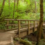
Take Highway 36 to Hellgate Campground. Cross Rattlesnake Creek Bridge to the Scott Flat Dispersed Camping Area. The trailhead is three quarters of the way through the Scott Flat Dispersed Camping Area, located at the footbridge.

Description

This trail has gentle grades making it very enjoyable for family hiking. In a few locations the trail does cross private property, so please be respectful.

No motorized vehicles are allowed on any portion of the trail.

A longer hike is available if you want to continue up river for ten miles to the Double Cabins site at the Wild-Mad Road (FS 29N30).You will encounter spectacular views from bluffs along the river, deep forests of fir, pine and oak, open meadows and a scenic river corridor. The South Fork of the Trinity River headwaters begin in the highest portions of the Yolla Bolly-Middle Eel Wilderness and flow northward to the main stem of the Trinity River. It is one of the most wild and scenic rivers in Northern California.

Current fishing regulations allow for artificial lures only with barbless hook November 1 through March 31. All trout and steelhead must be released immediately unless they show a healed adipose fin clip. See current regulations at www.wildlife.ca.gov/Regulations.

Additional Details

Width: 30 inches.
Primary Surface: Soil, compacted
Secondary Surface: None
Average Grade: 5%
Maximum Grade: 10%
Elevation Low Point: 2,200
Elevation High Point: 2,700
Elevation Gain (cumulative): Not Available

Year Designated:
1980

Supporting Webpages and Documents

Website: USFS Trail Details

Contact Information

For more information and current conditions, contact the trail manager (listed below). For questions, suggestions, and corrections to information listed on the website, contact American Trails.

Trail Management:
Sally Cousins
Recreation Staff Officer
US Forest Service
Trinity River Management Unit
PO Box 1190
Weaverville, CA 96093
(503) 623-1782
[email protected]
http://www.fs.usda.gov/stnf/


Photos

Ohlone Riders Unit heading thru burn area. Photo by Julie Green.

Ohlone Riders Unit heading thru burn area. Photo by Julie Green.

USFS and CCC staff check map for trail clearing. Photo by Julie Green.

USFS and CCC staff check map for trail clearing. Photo by Julie Green.


Showing new crew how to use the crosscut saw on a tree across the trail. Photo by Julie Green.

Showing new crew how to use the crosscut saw on a tree across the trail. Photo by Julie Green.

Reviews

No reviews are available. Be the first to leave one!


Submit an Edit

Trail Managers: please use the official NRT update form to update your trail for any of the following changes:

  • Change in trail mileage through trail extension
  • Change in trail mileage through trail retraction
  • Change in trail mileage through significant trail reroute
  • Change to trail name
  • Change in trail description or use
  • Undesignation of trail (removal of NRT designation status)
  • Other significant updates

>> Download the official NRT update form.

All other edits can be submitted via the below form: