South Dakota
George S. Mickelson Trail
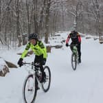
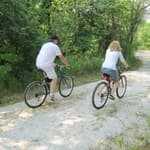
Imagine a path where the ghosts of Wild Bill Hickcock and Calamity Jane still roam; where bicyclists, hikers and horseback riders can explore spruce and ponderosa pine forests; and the very young, the very old and people of all abilities can enjoy.
Loop Trail? No
Type: Backcountry
Agency: State
Entry Fee? No
Parking Fee? No Allowed Uses:
Bicycling (off pavement)
Pedestrian - Walking/Hiking/Running
Location: Black Hills of South Dakota
State(s): South Dakota
Counties: Lawrence, Pennington, Custer, Fa
Longitude: -103.6396
Latitude: 43.81929
Driving Directions
Driving directions are not available for this trail. Can you provide this missing data?
Description
The George S. Mickelson Trail, in the heart of the beautiful Black Hills, was completed in September of 1998. Its gentle slopes and easy access allow people of all ages and abilities to enjoy the beauty of the Black Hills. Much of the trail passes through National Forest Land, but there are parts of the trail that pass through privately owned land, where the trail use is restricted to the trail only.
The trail is 109 miles long and contains more than 100 converted railroad bridges and 4 rock tunnels. The trail surface is primarily crushed limestone and gravel. There are 15 trailheads, all of which offer parking, self-sale trail pass stations, vault toilets, and tables.
A majority of the trail does not exceed a 4% grade, but parts of the trail are considered strenuous. Dumont is the highest point and the 19 mile stretch from Deadwood to Dumont is the longest incline.
Additional Details
Width: 96 inches.
Primary Surface: Crushed rock, compacted
Secondary Surface: Crushed Rock
Average Grade: 2%
Maximum Grade: 4%
Elevation Low Point: 3,490
Elevation High Point: 6,200
Elevation Gain (cumulative): Not Available
Year Designated: 2004
Supporting Webpages and Documents
Map: George S. Mickelson Trail MapContact Information
For more information and current conditions, contact the trail manager (listed below). For questions, suggestions, and corrections to information listed on the website, contact American Trails.
Park Ranger:
Harley Noem
SD Department of Game, Fish and Parks
11361 Nevada Gulch Rd.
Lead, SD
57754
(605) 584-3896
[email protected]
http://www.MickelsonTrail.com
Photos
Reviews
Submit an Edit
Trail Managers: please use the official NRT update form to update your trail for any of the following changes:
- Change in trail mileage through trail extension
- Change in trail mileage through trail retraction
- Change in trail mileage through significant trail reroute
- Change to trail name
- Change in trail description or use
- Undesignation of trail (removal of NRT designation status)
- Other significant updates
>> Download the official NRT update form.
All other edits can be submitted via the below form: